Natascha Mehler, 27 April 2017
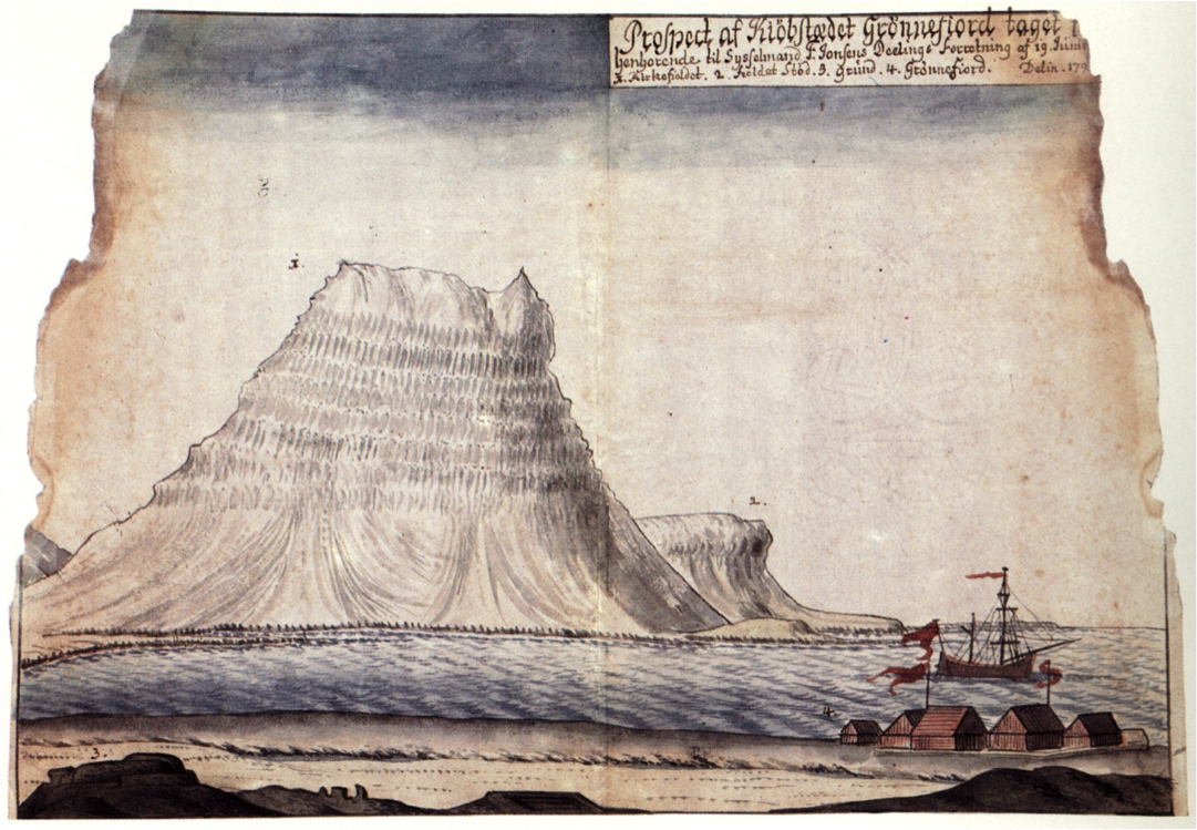
The Danish trading station at Grundarfjörður, as depicted in the 1790s. Before the Danes took over the trading post in the early 17th century it was in the hands of German merchants.
In the 16th century there were approximately 25 trading stations in Iceland which were regularly frequented by merchants from Bremen, Hamburg, Oldenburg or Lübeck. Most of these stations lay in the western part of the island, around the Snæfellsnes and Reykjanes peninsulas and in the Westfjords, because these were the areas where most fishing settlements were located and where cod, which was transformed into the main trading commodity stockfish, was abundant.
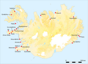
German trading stations in Iceland. Landey is near Kumbaravogur (map by Libby Mulqueeny, Mark Gardiner and Natascha Mehler).
It is difficult to tell what these German trading stations looked like because none have survived until today. In 1604, the Danish king Christian IV ordered to tear down all German buildings in Iceland, as a consequence of his imposition of the Danish trade monopoly (1602–1787). During the early 17th century many of the German trading stations (such as Grundarfjörður in the image above) were taken over by Danish traders and subsequently developed into permanent and more substantial settlements, many of which still exist today. What we don’t know is whether the Danish traders really tore down the German buildings, as was the will of the king, or simply re-used the buildings and infrastructure. The latter would certainly have been more practical in a country where building material was scarce.
Luckily, a handful of German trading sites did not develop into modern settlements and remains have survived until today. One of them is situated on the small tidal island of Landey at the northern side of the Snæfellsnes peninsula, near the present farm of Bjarnarhöfn. Written sources mention a trading post visited by merchants from Oldenburg and Bremen in the 1590s, but the amount of information from the surviving documents is very low. In 1593, Carsten Bake from Bremen acquired a three-years license for the harbour, and afterwards the harbour was given to the count of Oldenburg. In 1599, a request by the count to renew the license for Landey was denied by the Danish king because it was already in use by someone else. Who this person was is not mentioned.
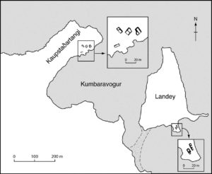
Ruins of German trading stations at Kaupstaðartangi and Landey (map by Mark Gardiner, Natascha Mehler and Libby Mulqueeny).
Today, Landey is a small island only used by sheep for grazing. The outlines of two buildings are clearly visible. They are situated on a small plain near a beach that was used as a landing site, to pull up small boats. The western side of the island faces a bay called Kumbaravogur, and on the other side of that bay lies Kaupstaðartangi, a headland where the remains of a trading station called Kummerwage have survived. This close proximity could be the reason why Landey started to be used as a trading post in the first place, as Kummerwage had been a harbour of Bremen merchants for a long time, but was given to Joachim Kolling from Oldenburg in 1580. Bremen tried hard to get the harbour back, but without success. The merchants of Bremen must have tricked the Danish king in requesting a license for the nearby Landey. When the king realised his mistake he included the clause that the license would go to Oldenburg after the Bremen one expired.
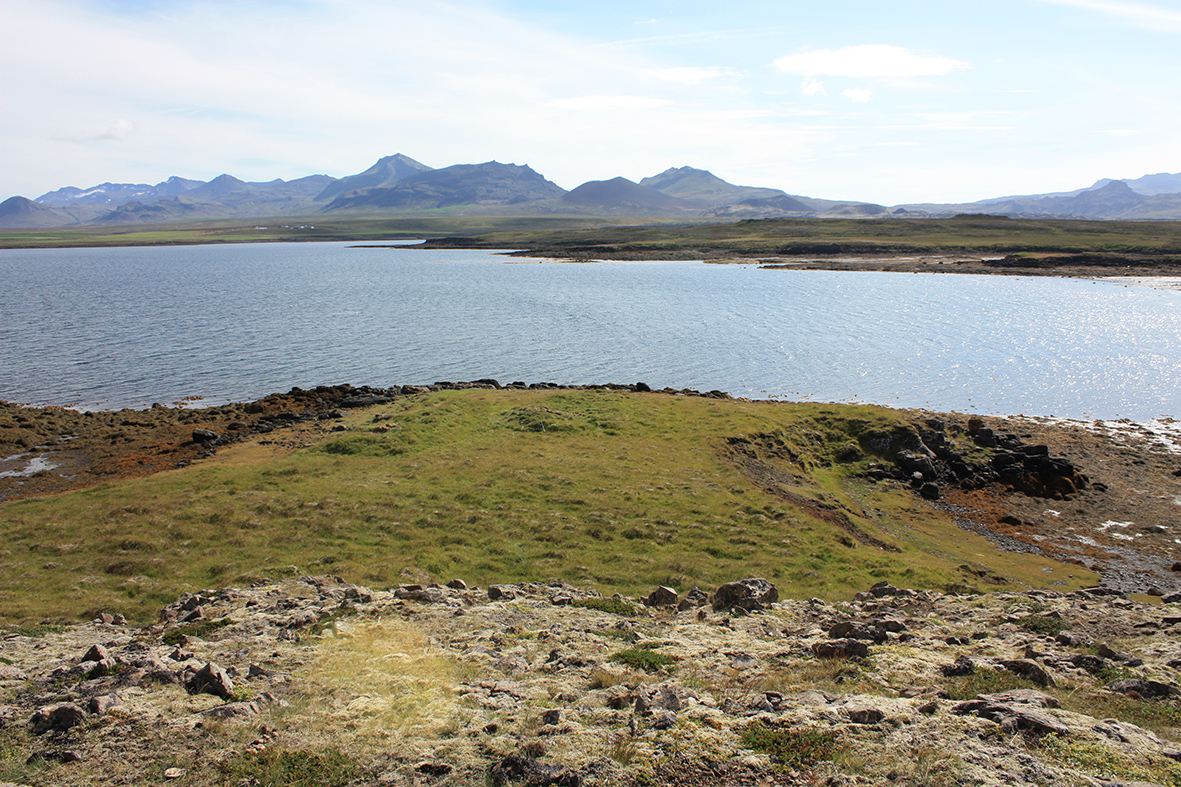
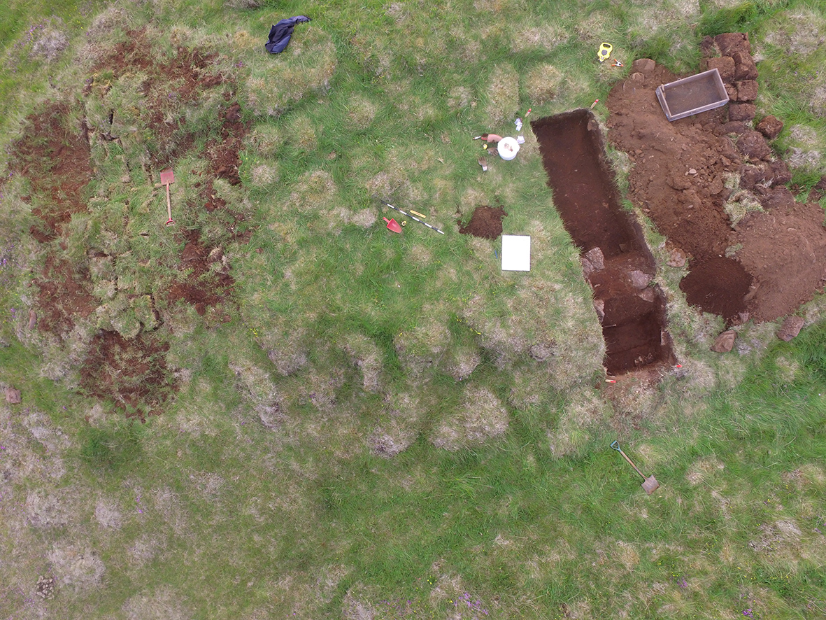
The ruins of two buildings at Landey (centre), on a green plain overlooking the landing site (image Natascha Mehler, 2016).
A trial excavation conducted with Fornleifastofnun Íslands at Landey in the summer of 2016 has shown that both buildings on Landey were indeed dwellings, although rather simple constructions. The walls were built in the Icelandic way, made of turf with stone linings. A fire place was discovered in the western building and no signs of furniture or other equipment were found. However, ten fragments of a ceramic cooking pot made of red earthenware were discovered. ICP-MS analysis of the sherds (conducted by Torbjörn Brorsson, KKS) has shown that the pot was made in Bremen, or in very close vicinity thereof (e.g. in Oldenburg).

The trial trench through the western building at Landey. The outlines of the building are clearly visible, as is the turf construction of the wall (image Vilmundur Pálmason, 2016).
The building to the east has two inner partition walls which indicates that it could have been used as a storage facility. Taking the scarce written and archaeological evidence together we can conclude that the buildings were indeed dwellings of some sort but only used for a very short time. This corresponds well with what we know about the Icelandic trading stations from other written sources: they were only used during the summers, when the foreign vessels were in Iceland, and their owners did not invest in solid infrastructure because they were not sure whether they would return the next summer. For Landey, records only exist for the 1590s.
Written sources indicate that merchants generally slept in the dwellings on land while the ship´s crew stayed on board. However, the excavations at Landey give food for thought. A Northern German merchant might have found it more comfortable to stay on board than to spend his nights in a damp and dark turf building…
References:
D. Kohl, Der oldenburg-isländische Handel im 16. Jahrhundert. Oldenburger Jahrbuch 13, 1905, 34–53.
Mehler & M. Gardiner, On the Verge of Colonialism: English and Hanseatic Trade in the North Atlantic Islands, in Peter Pope and Shannon Lewis-Simpson (eds.), Exploring Atlantic Transitions: Archaeologies of Permanence and Transience in New Found Lands. Society of Post-Medieval Archaeology Monograph 8 (Woodbrige 2013) 1-15.
Oldenburg, Niedersächsisches Landesarchiv, Best. 20, -25, no. 6.
Copenhagen, Rigsarkivet, Tyske Kancelli D 11, Pakke 28 (Island og Færøer, Supplement II, no. 25)
Posted in: Reports, Stories
Bart Holterman, 13 May 2016
The general history of the northern German trade with the North Atlantic is relatively well known but we know very little about the persons involved in this trade. This is especially true for the men that manned and sailed the ships that headed North.
Luckily, there are a couple of sources pertaining to the North Atlantic trade that give us a good insight into the people on board the ships. First, two boarding lists from Oldenburg for ships trading with Iceland in the 1580s have survived. Second, there is the magnificent book of donations of the Hamburg confraternity of St Anne, the socio-religious organisation behind the trade with Iceland, Shetland, and the Faroe Islands. From the 1530s onwards, the register lists the alms spent to the confraternity by the people on board of nearly every ship that returned to Hamburg, resulting in a more or less complete register of boarding lists.

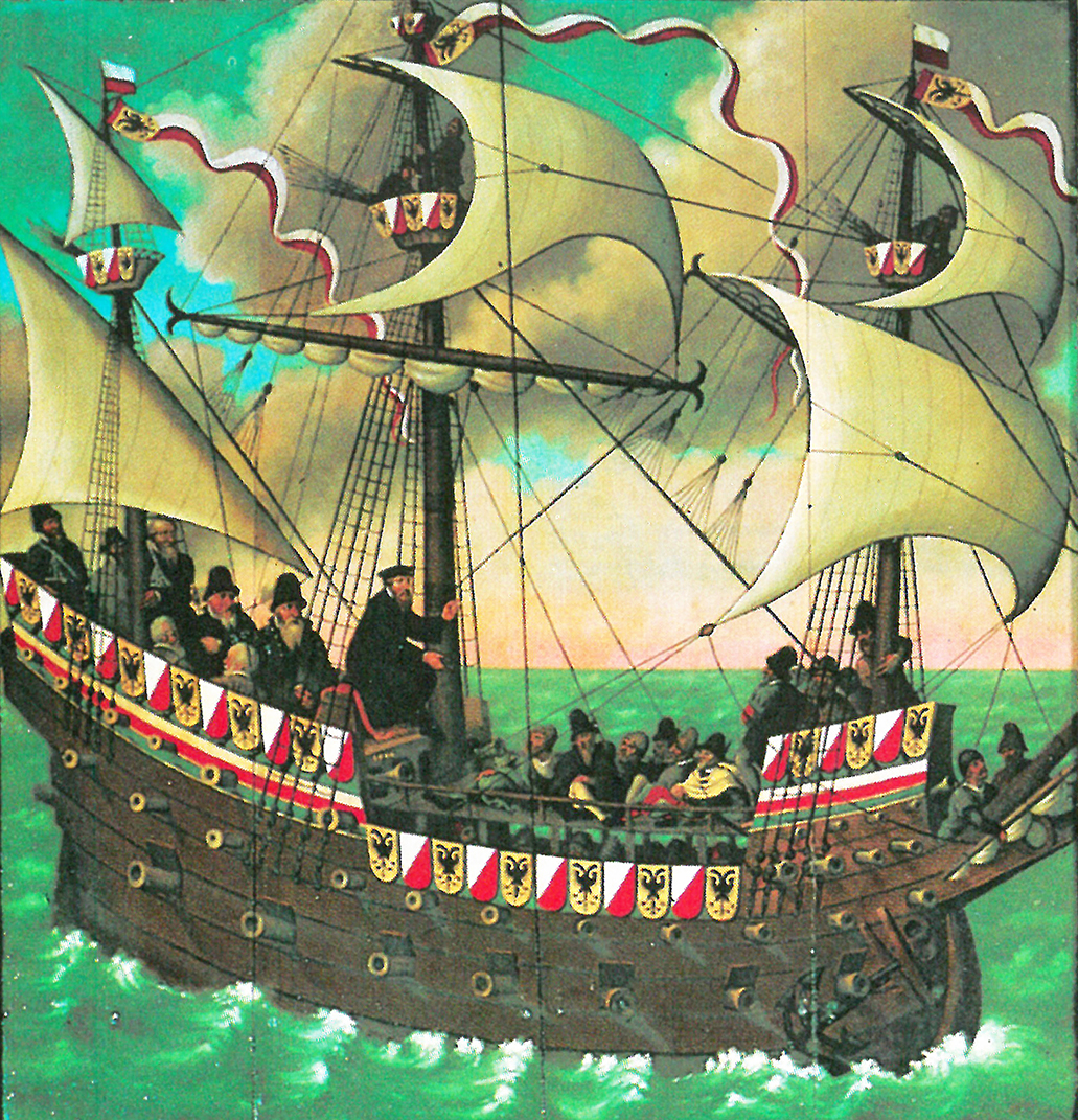
On board a sixteenth-century ship: detail of the epitaph for the ship´s priest Sweder Hoyer (deceased 1565) from the St Jacob church in Lübeck. Note: this image does not necessarily reflect the situation on board the merchant ships in the North Atlantic.
From these sources we can learn that the number of people on board varied greatly, ranging from 77 on larger ships up to around 10 on board the smallest vessels. For Iceland, it was not uncommon to have more than 25 people on board. Ships sailing to Shetland and the Faroe Islands had less people on board, usually 15-20.
This difference in number of people on board was mainly caused by the number of merchants on board. The sizes of the crews were relatively similar on each ship, because 10 to 15 people were needed to sail the ship, regardless of its size. A typical crew consisted of:
– Skipper (schipper). He was the captain, the leader of the ship, often also one of the merchants, and (partly) shipowner.
– Helmsman (sturman), the one who steered the ship and had navigational knowledge.
– Chief boatswain (hovetbosman), the leader of the sailors.
– Schimman, the officer responsible for rigging and other technical things.
– Cook (koch).
– Carpenter (tymmerman), responsible for repairs to the ship.
– Gunner (buchsenschut), responsible for the defense of the ship.
– Barber (bartscher), who had medical knowledge, but lacked on most ships.
– 2-4 sailors (bosman).
– 1-2 ship boys (putker), young sailors in training.
Besides these, ships transported merchants and their servants, falcon catchers, priests, and passengers from the islands which used the regular traffic to travel to and from the European mainland.
Further reading:
B. Holterman, Size and composition of ship crews in the German trade with the North Atlantic islands. In: N. Mehler (ed.), Traveling to Shetland, Faroe and Iceland in the early modern period (Leiden, in press).
F. C. Koch, Untersuchungen über den Aufenthalt von Isländern in Hamburg für den Zeitraum 1520-1662. Beiträge zur Geschichte Hamburgs 49 (Hamburg 1995).
Posted in: Sources, Stories